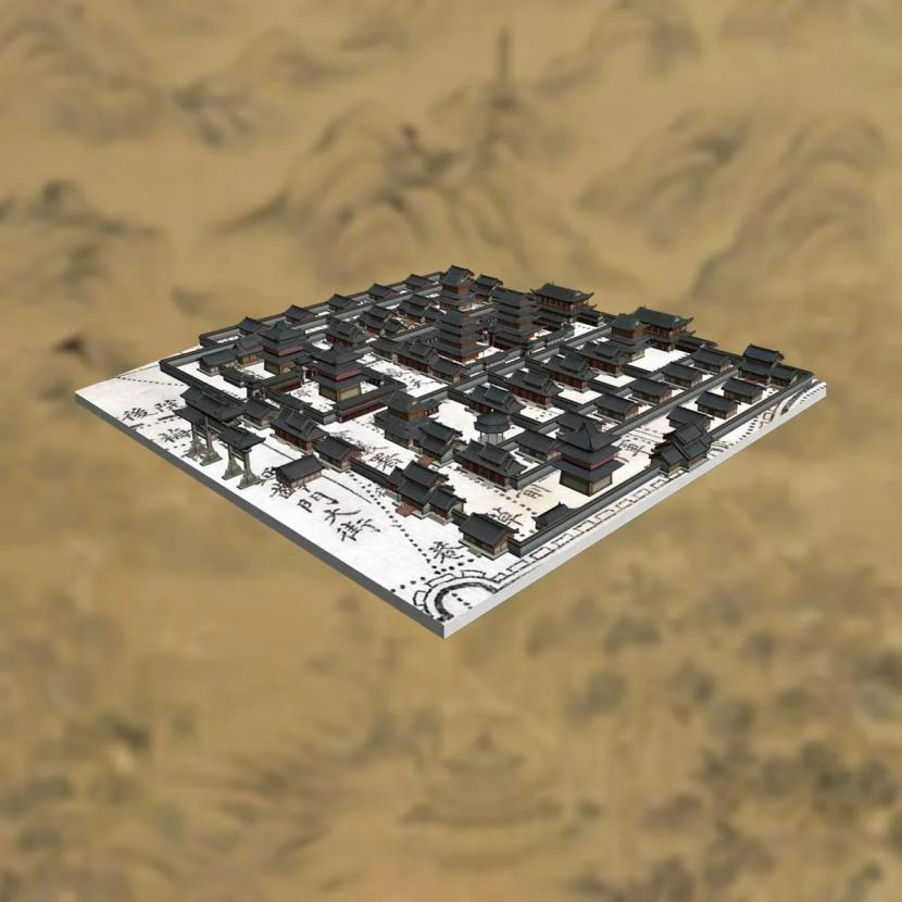


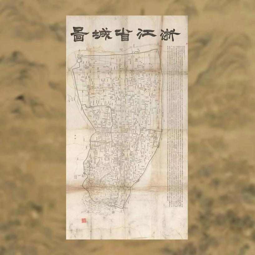
The Map of the Provincial Capital of Zhejiang was printed by Zhejiang Public Map Bureau in 1892 and was drawn in plotting method, which was rare in a large city’s map that has been handed down through generations. The accompanying note on the right side of the map provides a detailed introduction to the size of Hangzhou at that time and the excavation and dredging of the city’s water system. The map comprehensively illustrates the various elements of Hangzhou, including bridges, streets, alleys, official offices, academies, temples, pavilions, houses and waterways. Notably, the city walls are meticulously marked, with the ten major city gates and six water gates such as Wulin, Qiantang and Qingbo all vividly depicted.
The digital edition of the Map of the Provincial Capital of Zhejiang, released by Zhejiang Library this time, adopted 3D technology to depict the appearance of the city during that period. This small map not only records the layout of streets and alleys and building names in Hangzhou at that time, but also gives a glimpse of the amazing changes in the urban landscape of Hangzhou. During that era, Hangzhou even featured a night market, probably located in the area of the current provincial capital building. Despite the passage of thousands of years, the epicenter of life for Hangzhou residents remains within the city wall.
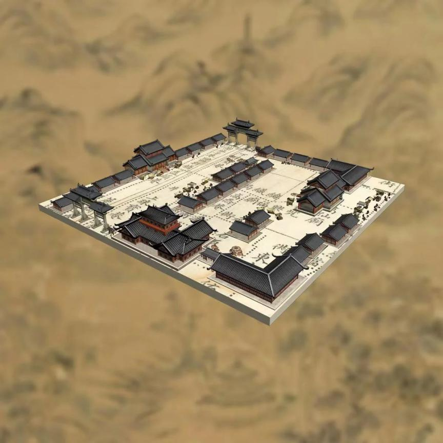
On the map, one can see the names and locations of city walls, gates, rivers, bridges, streets, lanes, official offices, academies, temples, pavilions and some mountains in Hangzhou, which vividly reflect the changes brought about by the historical context of the ancient capital of Hangzhou City, and this map is also a condensed representation of the urban layout and community distribution during the transition from ancient to modern times.